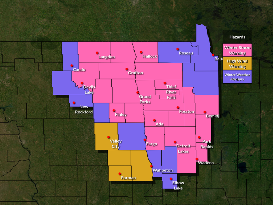
A second-round clipper snowstorm is marching across Minnesota on Tuesday, Dec. 9, and the track has shifted southward from initial expectations.
National Weather Service offices in Grand Forks and Duluth released midday forecast adjustments as storm impacts come into focus. A winter storm warning is in effect for a significant portion of the Northland from border to border as the storm tracks west to east.
Schools across the region have let students out early, and health clinics and businesses are closing early, while cities are declaring snow emergencies.
In Crow Wing, Cass and Aitkin counties, snow rates of a half-inch to 1.5 inches per hour are expected through the early evening. The most likely time for these higher rates is from 3 p.m. until 7 p.m.
Based on pressure trends, the Duluth office reported it has reduced the forecast snowfall amounts in the Arrowhead region and along the North Shore.

"We're also noticing the forecast low is trending weaker in strength, which means the winds causing blowing/drifting snow is less likely to be an issue," wrote Joe Moore, warning coordination meteorologist in Duluth, in an update. "This will be fairly light/fluffy so it will certainly blow around a bit, but we're talking more like gusts to 20-30 mph rather than 30-40 mph."
In the northwest and along the Minnesota-North Dakota border, the weather service no longer expects 60 mph winds in Fargo-Moorhead, and a high wind warning was canceled.
"However, we are still expecting winter warning- and advisory-type impacts for this area, mainly from accumulating snow, lowered visibility from heavy snow rates and eventual blowing snow," stated meteorologist Carl Jones. "There is also still some potential for additional light icing in a narrow zone between snow and rain within this area as well."
If you must travel, keep an extra flashlight, food and water in your vehicle in case of an emergency. Call 511 or visit 511mn.org for Minnesota road information.
-
And: Minnesota-based nonprofit says Big Tech fight reminiscent of Big Tobacco crackdown; and National Weather Service offering free weather spotter classes.
-
A Minnesota-based organization says concerned parents shouldn't settle for the status quo surrounding social media regulation.
-
The KAXE Music Team puts a wrap on March music with songs from The Outfit, Courtney Barnett, Kelsey Lu, Cat Clyde, Son Little and a double whammy from Irreversible Entanglements.
-
Camp Christopher in Cotton offers free camping for those impacted by suicide or mental health issues.
-
Events this week include a poetry and printmaking program at Arrowhead libraries, Bemidji Chorale concerts and a "Brain Train" event in Cohasset.
-
Ashkan Thibodeaux, 5, rescued his younger brother from an icy creek but couldn't pull himself out. He was flown to a Twin Cities hospital, where he remains.
-
The fires will help reduce overgrown vegetation and protect local communities from wildfires.
-
Hara Charlier accepted another position to be closer to family. An interim president will be appointed in May, and a national search for the next president will begin in the fall.
-
And: Central Lakes College President Hara Charlier is leaving the school; and a new report is concerned with the DNR's plans for electronic licenses this spring.
-
Volunteer Skywarn spotters help the agency deliver accurate and timely severe weather warnings. Training includes thunderstorm safety, the science of storms and cloud formation.


