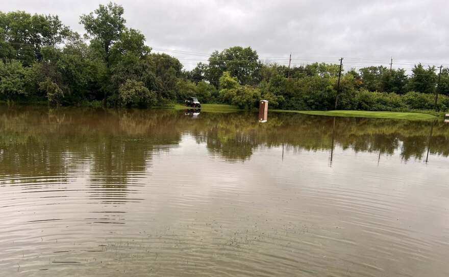
COHASSET — A line of powerful thunderstorms swept through Northern Minnesota early on Wednesday, July 23, knocking out power for thousands of customers from the Leech Lake Reservation to the Iron Range.
Lake Country Power reports the storm system first caused outages near Leech Lake and Walker, then continued through Grand Rapids, Blackberry, Goodland and areas south of Virginia, Cotton and Cromwell.
As of noon, the electric cooperative reports more than 1,700 without power and 50 separate outage locations left to restore.

Minnesota Power also reported 21 outages as of noon, with 2,600 customers without power, mostly in and around Eveleth. An earlier outage in Walker affecting upwards of 1,000 was mostly restored.
City utilties, including Grand Rapids and Hibbing, also reported outages after the storms moved through, which were restored by midday.
The National Weather Service placed a flood watch in effect through Thursday morning for most of Northern Minnesota.
Ely and Bemidji were under flash flood warnings Wednesday morning. The weather service stated between 6 and 12 inches of water were observed on Ely roads just before 11 a.m. There was more rain on the way.
The storm prompted hazardous road alerts in Cloquet for flooded streets.
Parts of Cass, Itasca and St. Louis counties were also under flood warnings and advisories. The weather service received reports of two to five inches throughout the Northland, including 4 inches in Knife River and Marble, 3 inches in Hibbing, Federal Dam and Carlton, 2 inches in Cohasset and Lutsen and 1.5 inches in Aitkin and Bigfork.
The weather service also reported tree damage caused by wind in Walker, Blackberry, Brevik and Palisade, and flipped pontoons on Big Sandy Lake.

With additional rounds of heavy rainfall expected through Thursday morning, more flash floods are possible around rivers, creeks, streams and other low-lying and flood-prone locations.
Beltrami County, still in the midst of cleanup from a windstorm on June 21, closed its demolition landfill and temporary mulch collection site due to flash flooding Wednesday.
-
Research indicates that in the coming decades, the state is likely to see more risk days of wildfires starting on the ground due to more extreme droughts connected to climate change.
-
Women Explore Fire Day in Minnesota offers hands-on opportunities to learn more about volunteer, paid on-call and full-time positions in local fire departments in all regions.
-
After 10,000 tree seedlings were claimed within 48 hours, the ReForest Bemidji program secured an additional 5,000 trees for its distribution May 18, 2026.
-
A recent national study found an increasing number of federal environmental impact statements are receiving significant contributions from citizen science data.
-
The multi-bill omnibus signed April 21, 2026, allows happy hours for nursing home residents without a license and expands local authority in some Northern MN communities.
-
The bill would define e-bikes as having output of no more than 750 watts, and motorized bicycles, 750-1,500 watts. Anything with higher power is defined as an electric motorcycle.
-
Three of the communities receiving grant funding in this cycle are in Northern Minnesota: Floodwood, Fosston and Deer River.
-
Rising health care costs are stressing K-12 teachers whose pay is already estimated to lag similarly educated professionals by more than 30%, according to a 2025 study.
-
Plus: Local and regional political organizers have been endorsing candidates for state and federal office; and a Hermantown speaker wins category while 22 other Northland speakers earned medals in state tourney.
-
The bill would establish rules for field trip supervision, improve mandatory reporting to include grooming and create a new felony offense for child grooming.


